Recent SOTA Activations

Sunday, August 21, 2022

Richard's Peak (W7M/LO-108) SOTA 7.2.2022

Richard's Peak Action W7M/LO-108

On 7/2/2022 we were camping on Middle Thompson lake and I decided to take an early morning trip down the Thompson River to try and activate Richard's Peak. The Thompson River is one of my favorite places to go and I had been down this road many times. In previous attempts the gate on the Richard's Peak road had always been closed or locked, today it was open. 

You can drive most any vehicle most of the way to the summit if the gate is unlocked. I believe that It is just short of a mile from the gate to the summit with room for a few vehicles at the gate without blocking it. 

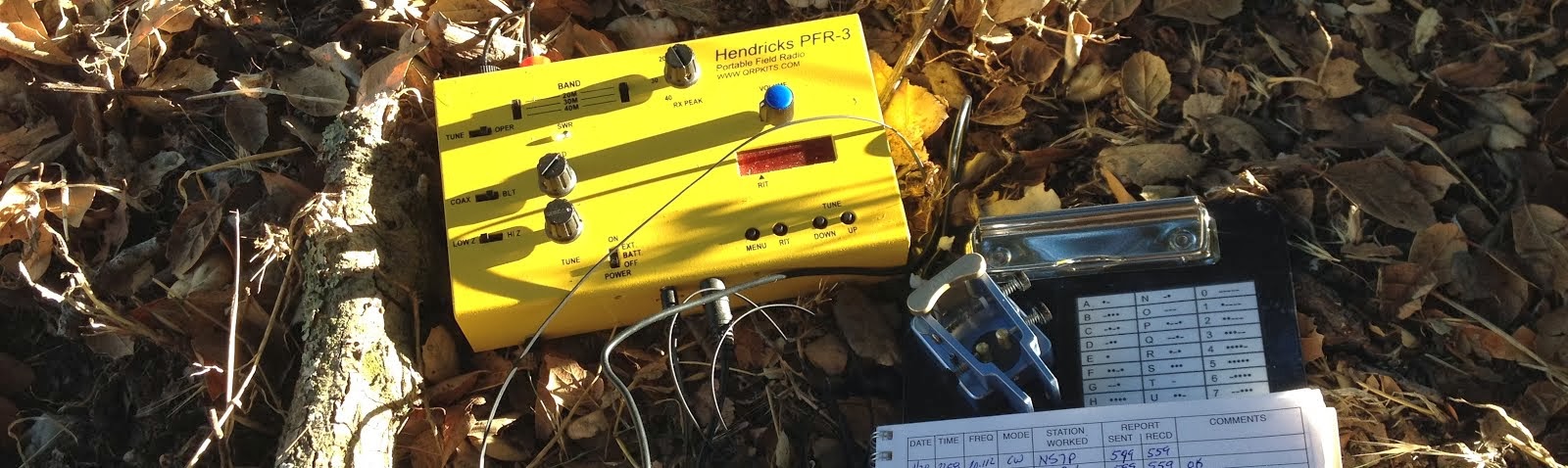
On the summit you will find a nice lookout tower that I believe is still in use during the summer months. There was no one there the day that I was there. I say on the deck of the lookout and used my Elecraft KX2. 

I had plenty of cell signal at the summit to make calls, text, or spot. There were also places on the way up the road that I had signal. I usually do not rely on cell signal on the Thompson river but it seemed to work decent in this area. 

Not many pictures today. This was taken on my walk off of the summit as a second thought.

I saw two Cow elk on the way off the summit and plenty of sign that they were around. I had a good conversation with a gentlemen that was using a e-bike and found that to be quite interesting. I have since bought an e-bike and it helps my wife to be able to go on longer bike rides with me. I get the added bonus to use it on the long gated roads to summits. 


Richard's Peak Lookout Information: 


Ousel Peak (W7M/FN-157) SOTA 8.6.2022

Ousel Peak is a peak in the Great Bear Wilderness that I have been eyeing to do for a while. The truth be told I started to hike this a couple years ago but noticed how steep it was and it was much to late in the day to make it to the summit. So on the 6th of August Colten and I made the hike. Starting about noon it was still much later in the day then I would have liked. 

The hike was about 3.7 miles one way with about 3,800’ of elevation gain. It had me breathing hard and the legs burning on the way up. The views are absolutely amazing and I am not sure that my pictures do it any justice. It is well worth all the work that it took to get to the summit. 

I used my MTR3B(LCD) on this hike with the elecraft T1 tuner on a 41' Random wire. On this hike I actually did take my MP1 Super Antenna but I made the choice to retire this antenna. My coil is just worn out and it is much heavier then I want to carry with me. Wires are much better for me and the Super Antenna is going to go back in the Antenna bin. This was left over from when I first started Summits on the Air and was using a FT857d, SLAB Battery, and the Super Antenna...not any longer though. 

I am working on a linked EFHW antenna for use with the MTR3 / ATS / or Rockmite radios that I have. 

I did not have any cell phone service at the summit for most of the time that I was up there. Although right when I was leaving I got a few notifications so I am sure that it is possible. I did all of my spotting using APRS. I would not count on having cell signal and come prepared. 


Sunday, July 10, 2022

Ashley Mountain (W7M/FN-193) SOTA

Ashley Mountain SOTA (W7M/FN-193)

Date: 26 June 2022

Summit Name: Ashley Mountain

Summit Coordinates: 48.28116, -114.71206

Distance: 10.83 miles R/T   Start Elevation: 4,915

Prominence: 1437'   Summit Elevation: 6,297 ft.    

Elevation Gain: 1827'          Elevation Loss: 1827'


https://listsofjohn.com/peak/29059

I am not sure exactly what I was thinking at this time but knowing that I can drive to the summit of Ashley Mountain I decided it would be a good idea to take the mountain bike. SOTA is primarily a recreation activity to get some exercise for me. I do love the drive up summits, especially in the winter, but I like to hike up or bike up as a better option. (A hike up to Blacktail mountain is in the future, Blacktail is a drive up at the top of a ski area). I parked near 48.25329, -114.73812 and followed the pine grass trail to the summit. I would say that this was about 50/50 riding and pushing the bike. I was motivated for the "easy" trip down and kept pushing the bike. 

Cell Signal: Minimal but workable. Was able to self spot using SOTA Spotter app.

APRS: Able to send and receive packets. I did not try spotting on APRS.

Trail Conditions: Trail was in good shape. No blow downs to contend with and plenty of water crossings for the dog to drink. 

Equipment Used: 

Elecraft KX2 with internal 11.2v battery. https://elecraft.com/products/kx2-ssb-cw-data-80-10-m-transceiver 

QRP Endfed Antenna 30 meters (k6ark.com). I used the endfed 30m antenna. I was able to tune it to the other bands with the KX2 internal tuner. 


Also check his QRZ profile...great things there also. https://www.qrz.com/db/K6ARK

Yaesu FTM400XDR - KF7PXT-9 (Mobile APRS) (aprs.fi/kf7pxt-9)

Yaesu FT3D - KF7PXT-7 (Hiking APRS) (aprs.fi/kf7pxt-7)

Radio Log:

HF was very tough today. I believe that this was field day and I could not hear a single thing on most of the bands. I switched bands and spotted multiple times with nothing. I was able to get AE1MS out of Georgia and surprisingly he was coming in strong.


https://huntsmarter.app.link/peLN1frezrb (Onx Tracking and Photos on Map)


 Echo was the highlight of the day. She enjoyed the trip!   

Lake Sylvia


In the video I was attempting to get a good video of the fish jumping. There were plenty of them jumping this evening. But either way you get a video of how awesome of a lake this is. (If you are from Oregon or California bring your bearspray and make sure you spray it all over yourself for this hike...the Grizzlies really like the taste of out of staters)...THIS IS A JOKE, DON'T SPRAY YOURSELF AND THEN SUE ME!! :)

Thursday, June 23, 2022

Wild Horse Mountain (W7M/FS-180) SOTA

Wild Horse Mountain SOTA (W7M/FS-180)

Date: 23 June 2022  

Summit Name: Wild Horse Mountain  

Summit Coordinates: 48.05624, -114.39098

Distance: 5 miles round trip   Start Elevation: 4,915

Prominence: 510'   Summit Elevation: 5,210'         

Elevation Gain: 564'          Elevation Loss: 280'

https://listsofjohn.com/searchres?textsearch=wild+horse&Search=Name&State=MT

Colten and I woke up around 6 and headed out to Wild Horse Mountain which was un-activated. We came in through the Kila area up towards Wild Bill and Emmons Creek Rd and then out through Kalispell on Patrick Creek. 

We parked at the gate at 48.04903, -114.36307. The walk was about 2.5 miles each way. The walk in on the roads are great but there is no real trail to the summit. There are plenty of game trails but you really just have to make your way up and find your way. I recommend staying to the ridge on the South east side as you can follow the edge of the thick trees and follow the ridge which is slightly less steep (not much). 

You can see that the area up to the summit is private. See below for information regarding this. 

Cell Signal: There was cell service at the summit and most of the way up. I relied on the reverse beacon network for spotting (Verizon).

APRS: I was getting out location reports for almost all of the trip (Driving and Hiking). Definitely would be able to use APRS to SOTA for spots and send messages from the summit.

Trail Conditions: Road was great...have fun on the last .5 mile assent up to the summit. Hopefully you can find a good trail.

Equipment Used: 

LNR MTR3B_LCD (https://www.lnrprecision.com/) w/9v Battery 

QRP Endfed Antenna 30 meters (k6ark.com). I am going to make this a tuned multi-band antenna but I have to work on some traps. I may start bringing a tuner with me and another antenna until I can get this done. There is the possibility that I only do 30m for the near future though.

Yaesu FTM400XDR - KF7PXT-9 (Mobile APRS) (aprs.fi/kf7pxt-9)

Yaesu FT3D - KF7PXT-7 (Hiking APRS) (aprs.fi/kf7pxt-7)

Radio Log:


The highlighted track that goes to the North is the way that we hiked to the summit. I would not suggest this route as the trees on the north side of the summit are very thick and hard to get through after you enter private land. 

https://huntsmarter.app.link/Pu8YrjoZ6qb

The highlighted route to the South is the way that we came off the summit and back to the truck. It is about the same distance and we dropped steeply off the summit but were able to avoid the thick trees and all of the side hilling. 

https://huntsmarter.app.link/1nCfaVqZ6qb

You can see that too the West of the State Land there is private and is labeled as "SPP Montana LLC." If you visit the website below you can see that this is permanent conservation land that was purchased "to permanently protect nearly 200,000 acres in Northwest Montana through “working forest” conservation easements." This company has bought a lot of land throughout NW Montana and it has many trails running through it. There are no signs preventing access. 


                               Summit View on Approach                        Echo hanging with us.


View of Blacktail on the way down.

Back at the truck

Thanks for Reading. 


Sunday, June 12, 2022

Mount Conner (W7M/LI-091) SOTA


This is the only picture that I took on the whole trip…I need to get back on my game. I also hid a geocache on the summit. We will see how long until it is found. 

Date: 12 June 2022

Hiking Time: 3:43

Summit Name: Mount Conner

Summit Coordinates: N 48 19.649 W 114 51.126

SOTA summit designator: W7M/FI 091                      Grid Square: DN28Nh

Elevation: 6147 ft.                                                           

Distance: 5.2 miles round trip

Vertical Gain: 1,375 ft.

Cell Signal:There was no signal until just short of the summit…probably the last .5 miles. There is no cell signal at the parking area or the whole drive after leaving Marion, MT. Was able to get data out (SOTA Goat spots) at the summit. (Verizon).

APRS Signal: I left my radio off until the summit. Was surprised to find that I did not get an APRS spot on the summit. 

Trail Conditions: Well maintained. No other parties encountered during the trip. No wildlife spotted but saw plenty of Elk sign. 

Equipment Used: Yaesu FT3D for APRS and FM contacts. Elecraft KX2 was in my bag for HF but I did not have time to deploy because of weather. 

Radio Log:


Weather: I sat in my house all weekend worried about the flood watch and rain that we were supposed to get. I kept looking out at the sun and decided to make a go for it. We did not get any rain until it started to sprinkle on the summit. I had the HT out and made a few contacts as I watched dark clouds coming my way. The wind started to pick up as I was talking to N7LT and I decided it was time to go. Once we got off the ridge the wind stopped and we had a great walk back to the truck.


Friday, May 15, 2020

Cinnamon Mountain (W7M/HB-030) SOTA


My wife and I were in the bigsky area for a conference and took some time just the two of us. Because I am not much of a formal person and prefer to be out walking I decided to head out and do a little hiking. One thing I learned about this area is that it is remote. There is very little APRS signal or cell signal...or people. 

Date: 22 August 2019

Summit Name: Standard Peak

Summit Coordinates: 48.5419 N 114.2471 W

SOTA summit designator: W7M/FN-153.                        Grid Square: DN28vn.

Elevation: 7,196 ft.                                                            Prominence: 1,476 ft.

Distance: 6.2 miles round trip

Cell Signal: Had signal for most of the trip and was able to send spots at summit using SOTA Goat (Verizon).

APRS Signal: I was hitting digipeaters after making the ridge. Definitely would be able to use APRS to SOTA for spots and send messages from the summit.

Trail Conditions: Well maintained. 2 other parties encountered during the trip. There were plenty of Huckleberries along the trail. Bring a Container.

Equipment Used: Kenwood TM-D72 for APRS and FM contacts. Elecraft KX2 for HF. Homebrew dipole antenna (20m).

Radio Log:

Cinnamon Mountain Statistics:

Elevation - 9,231 ft.
Prominence - 1,431 ft.

Cell Signal (Verizon): There was no signal on the hike up. As soon as I got to the summit I had signal but this is not something that I would count on. I would have LTE, then 3G, then nothing all in a few seconds. I was able to use SOTA Goat to get my spots out but I don't know if I would rely on this being a sure possibility.

Trail Conditions:  Great!


Monday, October 21, 2019

Standard Peak (W7M/LM-153) SOTA


Not a lot of pictures today. Standard is the peak that is in the back left of the photo. My daughter and I had a great hike up to the summit of this previously unactivated peak. The weather was calling for rain but we decided to make a go at it. We did not get any rain until the way back down off of the summit and then we got dumped on. We did hear a little bit of thunder but saw no strikes. A great hike.

Date: 8 September 2019

Summit Name: Standard Peak

Summit Coordinates: 48.5419 N 114.2471 W

SOTA summit designator: W7M/FN-153.                        Grid Square: DN28vn.

Elevation: 7,196 ft.                                                            Prominence: 1,476 ft.

Distance: 6.2 miles round trip

Cell Signal: Had signal for most of the trip and was able to send spots at summit using SOTA Goat (Verizon).

APRS Signal: I was hitting digipeaters after making the ridge. Definitely would be able to use APRS to SOTA for spots and send messages from the summit.

Trail Conditions: Well maintained. 2 other parties encountered during the trip. There were plenty of Huckleberries along the trail. Bring a Container.

Equipment Used: Kenwood TM-D72 for APRS and FM contacts. Elecraft KX2 for HF. Homebrew dipole antenna (20m).

Radio Log:
Thanks everyone for the contacts. Special thanks to Martha and Gary for the Summit to Summit contacts. Also to the locals who keep tabs on the kids and I and make sure that we make it out safe.