Recent SOTA Activations

Sunday, August 21, 2022

Richard's Peak (W7M/LO-108) SOTA 7.2.2022

Richard's Peak Action W7M/LO-108

On 7/2/2022 we were camping on Middle Thompson lake and I decided to take an early morning trip down the Thompson River to try and activate Richard's Peak. The Thompson River is one of my favorite places to go and I had been down this road many times. In previous attempts the gate on the Richard's Peak road had always been closed or locked, today it was open. 

You can drive most any vehicle most of the way to the summit if the gate is unlocked. I believe that It is just short of a mile from the gate to the summit with room for a few vehicles at the gate without blocking it. 

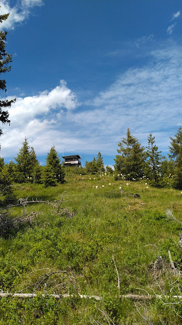
On the summit you will find a nice lookout tower that I believe is still in use during the summer months. There was no one there the day that I was there. I say on the deck of the lookout and used my Elecraft KX2. 

I had plenty of cell signal at the summit to make calls, text, or spot. There were also places on the way up the road that I had signal. I usually do not rely on cell signal on the Thompson river but it seemed to work decent in this area. 

Not many pictures today. This was taken on my walk off of the summit as a second thought.

I saw two Cow elk on the way off the summit and plenty of sign that they were around. I had a good conversation with a gentlemen that was using a e-bike and found that to be quite interesting. I have since bought an e-bike and it helps my wife to be able to go on longer bike rides with me. I get the added bonus to use it on the long gated roads to summits. 


Richard's Peak Lookout Information: 


Ousel Peak (W7M/FN-157) SOTA 8.6.2022

Ousel Peak is a peak in the Great Bear Wilderness that I have been eyeing to do for a while. The truth be told I started to hike this a couple years ago but noticed how steep it was and it was much to late in the day to make it to the summit. So on the 6th of August Colten and I made the hike. Starting about noon it was still much later in the day then I would have liked. 

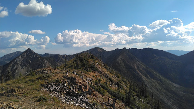
The hike was about 3.7 miles one way with about 3,800’ of elevation gain. It had me breathing hard and the legs burning on the way up. The views are absolutely amazing and I am not sure that my pictures do it any justice. It is well worth all the work that it took to get to the summit. 

I used my MTR3B(LCD) on this hike with the elecraft T1 tuner on a 41' Random wire. On this hike I actually did take my MP1 Super Antenna but I made the choice to retire this antenna. My coil is just worn out and it is much heavier then I want to carry with me. Wires are much better for me and the Super Antenna is going to go back in the Antenna bin. This was left over from when I first started Summits on the Air and was using a FT857d, SLAB Battery, and the Super Antenna...not any longer though. 

I am working on a linked EFHW antenna for use with the MTR3 / ATS / or Rockmite radios that I have. 

I did not have any cell phone service at the summit for most of the time that I was up there. Although right when I was leaving I got a few notifications so I am sure that it is possible. I did all of my spotting using APRS. I would not count on having cell signal and come prepared.