Recent SOTA Activations

Showing posts with label Geocaching. Show all posts

Sunday, July 22, 2018

Big Arm Point (W7M/LM-168) SOTA Activation


On Friday 16 March Kimber and I were making a trip to Missoula to pick up my daughter. I decided that it had been a while since I had the radio out and wanted to enjoy the good weather that we were having. I made a decision not to post an alert for this summit as I did not know if it would actually happen, depending on the road conditions.  I also  knew that I would have cell signal to self spot, I had been up on this summit 2 times prior. This summit is a drive up as there is TV and other misc. towers at the top and they keep it plowed most of the time. There is a Dozer at the bottom of the hill that I presume is there to keep the road open in the winter. Even though they keep this road plowed it can still be very bad at times and most of the winter would still probably require chains to get to the top. Mid winter I took the expedition up there with no chains and was in 4wd for the entire trip. There was a couple shady times that I would have preferred chains for traction. There are sections that warm up in the sun and create a sheet of ice that can cause you sliding towards the edge...which at time is very steep. In the summer about any car can make it to the top with some easy driving and maneuver around some larger rocks. I had my Subaru Impreza outback up there last summer. Today I was able to drive most of the way in 2 wheel drive but periodically put the Expedition in 4 wd in order to get a little more traction on the steep icy spots.


Cell Signal: 
I use Verizon and had great cell phone signal from the summit. 

Trail Conditions
This is a drive up and on a gravel road to the summit. I parked on the second to last switchback and walked the rest of the way to the summit. 

Fees:
This area requires a tribal use permit for non-tribal members. You can pick these up at the Walmart in Polson or at Ronan Sports and Western. 

APRS:
Did not use APRS today.

GPS Tracks:

https://www.dropbox.com/s/2xiufzxtexvn5xr/Big%20arm%20point%20gpx%20file.gpx?dl=0

This link will take you too my driving tracks from where I parked to HWY 93. If there is an issue with the link let me know and I will try and figure it out. 


Driving Directions:
HWY 93 just north of Polson, MT will take you to where my GPS tracks start. Link above.

Summit information and resources used for planning

I use this free website to estimate distances of new trails.

Here is one of my secrets!!! Even if you don't do geocaching take a look at the map. If you manipulate it right up can see every summit out there. If there is a geocache at the top, there is a way to get there. Sometimes if you click on the cache it will even give detailed directions to get there and some good pictures.

Here is an example of some decent directions learned from a geocache. The information was out dated but much of the time it is not.

I link to this site from my blog and from my blog to this site. This site is great because it posts the necessary information straight to the Summit Page.

http://www.cqgma.net/mvs/index.php
Adventure Radio Map View - I like this map as a way to see the summits. It seems more user friendly with filters then the SOTA mapping software.

http://www.nohrsc.noaa.gov/interactive/html/map.html
NOHRSC Interactive Snow Information - This is a great tool to see where the snow levels are and what they have looked like in the past on certain dates.

http://www.gpsvisualizer.com/draw/
Put in a route in this site and it will give you a gps file for the information you provide. This works if you want to draw and upload a route into your GPS for use on the trail.


4590 (W7M/FN-235) SOTA Activation


My wife and I made the 5.8 mile R/T hike up to Point 4590. This is a great hike in the Kalispell area and gives way to great views as can be seen from below. There is also a trail that continues on down to the lake as seen from the map below.  The trail has been well maintained. We have been to the area now on two different occasions with not many people there. Today we ran into a group of two hikers and a mountain biker came to the top while we were up there. This is a fairly long hike for a 1 Point SOTA summit but if you are in it for more then SOTA it is a great choice. For those of you that do Geocaching there is also a geocache just off the trail and before the summit. The view from below in only about 30 ft off of the summit so is well within the activation area. The summit has a good amount of trees and there is not much of a view. This summit is probably not a good choice for those collecting points but it is a good hike with a great view...and worth the hike to be the first to activate.  


I tracked our hike with my Garmin on the way up. The GPX tracks can be found here: https://www.dropbox.com/s/ym8gatbu9kjgilm/Track_2018-07-21%20135244.gpx?dl=0
Forest Service Rd. 2924 Takes you to the Trailhead. You can drive most any vehicle to the TH during the summer months. There are a few rutted areas but I think that if you are careful that you can drive through them in any vehicle.

Driving GPS Tracks (Click Here)

I spent a good deal of time trying to Call and also tried 17m SSB, 20m CW, 40m SSB. With no luck. Not sure what was going on today.


Equipment:
Elecraft KX2 with KXPD2 and internal battery. MP1 Super Antenna, Kenwood TH-D72 for 2m and APRS.

Cell Signal(Verizon): 
I use had decent cell phone signal from the summit. I spotted a few times using SOTA Goat and was able to spot with out any issues. LTE/3G signal most of the time.

Trail Conditions
5.8 Miles on a well maintained single track trail. Shared with Horses, Bikers, and Hikers.

Fees:
None

APRS (Kenwood TH-D72):
I did my initial spot using APRS. I like to keep proficient in these uses. It was a good thing that I did it as it took some getting used to again. 

Driving Directions:
From Kalispell, Farm to Market Road, Tally lake Road, FR2924

Band Conditions:
I was not able to work near as many stations as I am used to. Band conditions were not that great but I was able to get a few contacts. Two of my normal contacts N4EX and W0MNA were not able to make the contact. I could here them fine but was not able to complete the contact on my end.

Summit information and resources used for planning

I use this app to estimate distances of new trails.

Here is one of my secrets!!! Even if you don't do geocaching take a look at the map. If you manipulate it right up can see every summit out there. If there is a geocache at the top, there is a way to get there. Sometimes if you click on the cache it will even give detailed directions to get there and some good pictures.

Here is an example of some decent directions learned from a geocache. The information was out dated but much of the time it is not.

http://www.cqgma.net/mvs/index.php
Adventure Radio Map View - I like this map as a way to see the summits. It seems more user friendly with filters then the SOTA mapping software.

http://www.nohrsc.noaa.gov/interactive/html/map.html
NOHRSC Interactive Snow Information - This is a great tool to see where the snow levels are and what they have looked like in the past on certain dates.

http://www.gpsvisualizer.com/draw/
Put in a route in this site and it will give you a gps file for the information you provide. This works if you want to draw and upload a route into your GPS for use on the trail.

Thursday, September 15, 2016

"Frequency Mountain" W7W/SO-094 SOTA

On Sunday, 11 September Delma, Brookelyn, Makaila, Kimber and I went out for a hike. During the hike we did a little geocaching and also made a quick attempt at a local SOTA summit. The total hike was 7.86 miles but this included many quick stops and wanderings to find geocaches. As the trip shows below we started at 12: 54 in the afternoon and were walking for just over 5 hours. Walking with a 3 year old can be slow. There were many short stops along the way to look for caches, drink water, or just explore something in the woods. We all had a great time.


A long hike for the group but everyone seemed to have a great time. 


We have Geocached a lot in this area but this is the first time that we have made it all the way to the top. If you are into geocaching on fairly easy hikes then this is a great one.  As you can see there are many more reasons for us to get up in these woods again. We are thinking about pre positioning a vehicle on the other side and hiking all the way over the top. There is plenty of room for Caches on the other side. The kids had a blast!


A screen shot for the easy SOTA summit. I only managed one contact but we also only stayed on the summit for about 10 minutes. This is a great local summit and a fun place to get out and walk the dogs. We will definitely be back to this one for a full SOTA activation.


Thanks Eric for answering my CQ call.


It is all forest road on the way up. There is a gate at the bottom so you would need a key to get through. All this is Stimson Lumber land and apparently you can get a permit to drive on the roads because I periodically see vehicles on the roads. On this trip we did run into one care. On the right is one of the Geocaches that we found. 


In the picture it shows me with the rubber duck but I actually did put on the telescoping whip and gave it a couple calls with the Kenwood TH-d72a.


 Brookelyn and Colten checking out the loot in one of the Caches.


The kids made a killing today trading a bunch of stuff for some new cool toys. We will have to bring up some more cool stuff to trade up here the next time!


 One of them was up in a tree and required a little help, hid nearby, to get the cache down to hand level. 


We found a number of aliens in the woods today. Seemed to be an invasion of some kind!


On the way down, Delma got a head of the kids and I and had time to take a couple selphies. This is the longest hike we have done in a while and we will do it again soon to get a full activation.


Monday, August 1, 2016

Mount Catherine (W7W/CW-066) / Denny Creek Water Slide / Wynoochee Falls

On Saturday 30 July Lily (12), Brookelyn (7), Kimber (3) and I headed to Mount Catherine for a hike and SOTA activation. This was the second time that Lily and I had done Mount Catherine. Peyton was with us last year but his year he was visiting his dad in Montana, he will be back next weekend with hopes to hit Mount Townsend (TBD).

I had talked to Chris, WX7EMT, a couple days prior and I knew that he was planning on doing Mount Defiance also today. I figured that I would be able to work him while I was driving up to Catherine and possibly get up in time to get a summit to summit with him. It turns out that Chris got a late start due to his wife having a flat tire and decided to do Catherine also.

On the drive up 146.52 was really busy with SOTA activators. I was able to work KG7VIZ on Mount Pilchuck, WX7EMT on Mount Catherine, and K3OG on Big Snow Mountain just on 146.52 on the way to the trail head. I know that there was a couple other activators on frequency also, one was on Green Mountain and another on Fremont lookout but not within the activation area for SOTA.

We got to the trailhead and started hiking at 1330, a little later then planned but this is what happens when you head out with young kids. As you can see by my Fit bit profile below the hike was 1.83 miles with 1,407 ft of elevation gain and took us 1:17 minutes. We really took our time with Kimber (3 years old) but we had a fun trip, Little 3 year old legs do not move very fast, but she is doing great considering she has juvenile idiopathic arthritis, she does really great all things considered. Sometimes dad gets a little more exercise when she needs to be carried.

On the way to the summit we were able to meet Chris, WX4EMT, coming down from his activation.


Once I got to the summit I quickly decided not to do HF (Sorry Chasers)! The summit block is very small and there was quite a bit of hikers up today. With Kimber I also wanted to keep a close eye on her because it would be easy to fall off the summit in all directions. So we sat and enjoyed the view and I used the Kenwood to work contacts on VHF. The first contact I got was K3OG. Peter was nice enough to wait for me to get to the summit so that I could get a summit to summit contact. I wanted to work him so that he could start his trip off the summit. I knew that he had a long trip down from Big Snow Mountain. 


I ended up getting 7 contacts with the HT and did not have to work hard at it. In fact my first 3 contacts were on frequency waiting for me to get to the summit. Thanks Peter, Chris, and Doug for being there waiting for me!! 


After we made the hike off the hill we headed down to Denny Creek to the natural water slide. Here is a link to the Washington trail association hike: http://www.wta.org/go-hiking/hikes/denny-creek
The site states that it is 6 miles round trip but if you only go to the water slide it is less then three miles. We hit the water slide at just over one mile and the other half mile was exploring. There is a lot to explore and it is a great time!!! Pictures below show our waterslide trip.


 On Sunday we did a day trip to Wynoochee Lake and Falls. This is another short but fun hike with swimming for kids. Here is a link for that: http://www.wta.org/go-hiking/hikes/wynoochee-falls If you are ever in this neck of the woods and you have kids they will love these places. See pictures below.


I shared a little more about our weekend then just our SOTA trip but there is so much more that we do on a typical weekend then just SOTA. We are a busy family. I drag my kids to much more then just mountain tops! 

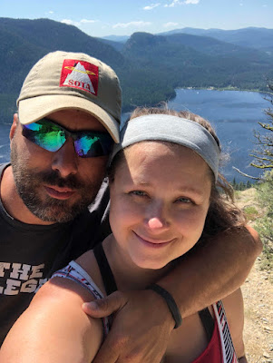
My wife and I were just commenting how we never have pictures of each other. I guess we are going to have to get better at that. 

Thanks everyone for reading my blog. I love the comments and emails that we get on them and they are a lot of fun. It is also a great way to keep memories to look back at later. 

See you all on the next one...thinking Mount Townsend on Saturday 6 August with Lily and Peyton...of course everything is subject to change in the Conover family!

Lily is working on a Video of our trip right now and I will upload to YouTube and attach to the blog when she is complete. She loves shooting video and editing so it will be great to see what comes out.

73,