|
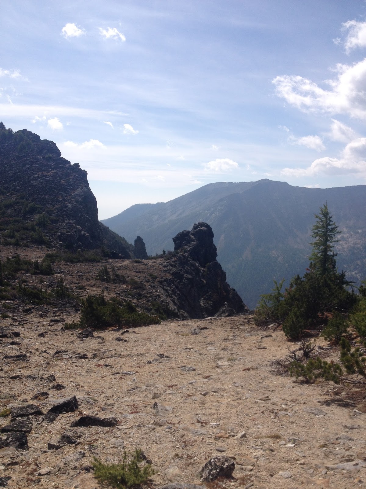
| Our first view of the Lookout. |
 |
Here is our GPS tracks to the summit. As you notice we had to start a little farther to the south on the road. The forest service has put up a post to stop you from driving up any further. The road portion is an easy walk. After that you hit the switchbacks which will get you winded. Then the short easy stretch to the lookout.
Cell Signal:
Cell signal (Verizon) was very spotty on the summit. Sometimes I would have nothing and then I would have some analog. At one time I looked at my phone and saw 4 bars 3G. Crazy cell signal don't rely on it.
Repeaters:
Did not try any repeaters up here. I did make a few contacts on 146.52 FM.
Repeaters:
Did not try any repeaters up here. I did make a few contacts on 146.52 FM.

Trail Conditions
1.5 miles great trail. Steep with a lot of switchbacks.
Fees:
Pass may be required. We put them all on the dash just in case.
APRS:
Worked great from the summit but not so much on the way up
 |
| Mount Rainier behind the Lookout |
 |
| A peek inside |
 |
| Benchmark |
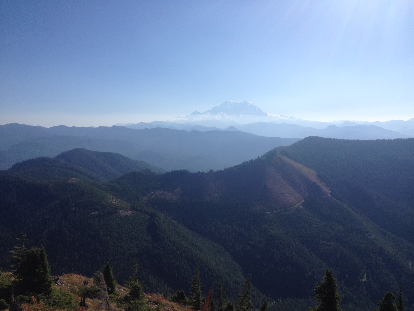 |
| Mount Rainier |
 |
| 20 Total contacts today; 14 of the Summit to Summit. |
 |
| Check out my points per activation (2.40) If I ever do make it to Mountain Goat I am pretty sure that I am going to have the most summits activated when I make it. I was talking to Doug and saying that some of my 1-2 point summits have been more difficult then my 6-8 point summits. I love just getting onto the Summits! |
 |
 |
| My summit to summit log for today |
 |
| Thanks to all the great chasers that make it so much fun out there....and to my wife for giving me a pass! |
 |
| I realized that this was my first W7W/KG summit that I activated!
Summit information and resources used for planning
I use this app to estimate distances of new trails.
Here is one of my secrets!!! Even if you don't do geocaching take a look at the map. If you manipulate it right up can see every summit out there. If there is a geocache at the top, there is a way to get there. Sometimes if you click on the cache it will even give detailed directions to get there and some good pictures.
Here is an example of some decent directions learned from a geocache. The information was out dated but much of the time it is not.
I link to this site from my blog and from my blog to this site. This site is great because it posts the necessary information straight to the Summit Page.
Adventure Radio Map View - I like this map as a way to see the summits. It seems more user friendly with filters then the SOTA mapping software. http://www.nohrsc.noaa.gov/interactive/html/map.html NOHRSC Interactive Snow Information - This is a great tool to see where the snow levels are and what they have looked like in the past on certain dates. http://www.gpsvisualizer.com/draw/ Put in a route in this site and it will give you a gps file for the information you provide. This works if you want to draw and upload a route into your GPS for use on the trail.
This website will have a ton of information on Washington summits. I use this site often.
Another site with a lot of information. This works great for summits without official trails. Sometimes you can even get GPS tracks off of here.
|