

 |
| Jumbo Geocaching |
 |
| Caches from Lolo Peak |
 |
| A couple notes on this track...it is approximate. Where the waypoint is bring a fishing pole for some fresh trout! Follow the track to the South side of the lake for the best route then follow the ridge...carefully |
Log:
 |
| My complete log from SOTA Watch. |
 |
| KE5AKL's log with our S2S contact |
Cell Signal:
Cell signal (Verizon) most of the way up and great at the summit. No issues with digital spotting.
Repeaters:
I was able to use the Point 6 Repeater 147.040 (No PL) and Patricks Knob Repeater 147.14 PL103.5 withou any issues. I had great simplex signal into the Bitteroot and Missoula Valleys with 2m contacts from each.
Repeaters:
I was able to use the Point 6 Repeater 147.040 (No PL) and Patricks Knob Repeater 147.14 PL103.5 withou any issues. I had great simplex signal into the Bitteroot and Missoula Valleys with 2m contacts from each.
Radio working conditions:
No noise...great conditions.
Trail Conditions
The first 4.5 miles of trail to Carlton lake is great with only one blow down over the trail. After the lake it is all route finding, steep but easy to find your way
Weather:
53 degrees at the car at 0800. Windy and chilly on the summit.
Fees:
None
APRS:
I used my new TH-D72 for the first time on this activation. I sent an email to Stewart (stewart.g0lgs


Thanks to all the chasers who took the time to come and find me, and Mike (KE5AKL) who took the time to work with me on the S2S contact. A special thanks to Dean (KJ6CQC) for giving me a call and letting everyone locally know that I was up on the summit. Dean also sent me an APRS message, it was good to see this feature work on the radio!
My time is much more limited then it was a couple years ago. It seems that my kids are getting older and more demanding of my time. The Army is expecting more time from me also. Just this last summer I went over my 18 year mark in the Army. I know this sounds like OMP (Old man problems) but the military has taken its toll on me. I can still get out and travel some miles but the consequences are getting worse as I get older :) Thanks again!
 |
| This is the high water mark from Glacial Lake Missoula. This one is on the side of Mount Jumbo but you can find them on the hills around the valley. |
 |
| The kids on the "L" on the side of Mount Jumbo. Notice how smokey it is down in Missoula. |

 |
| Very Smokey |

 |
| Nice big blackbear. |
 |
| Peyton on the Trail up to Lolo Peak. The first 4.5 miles were all nice trail like this. |
 |
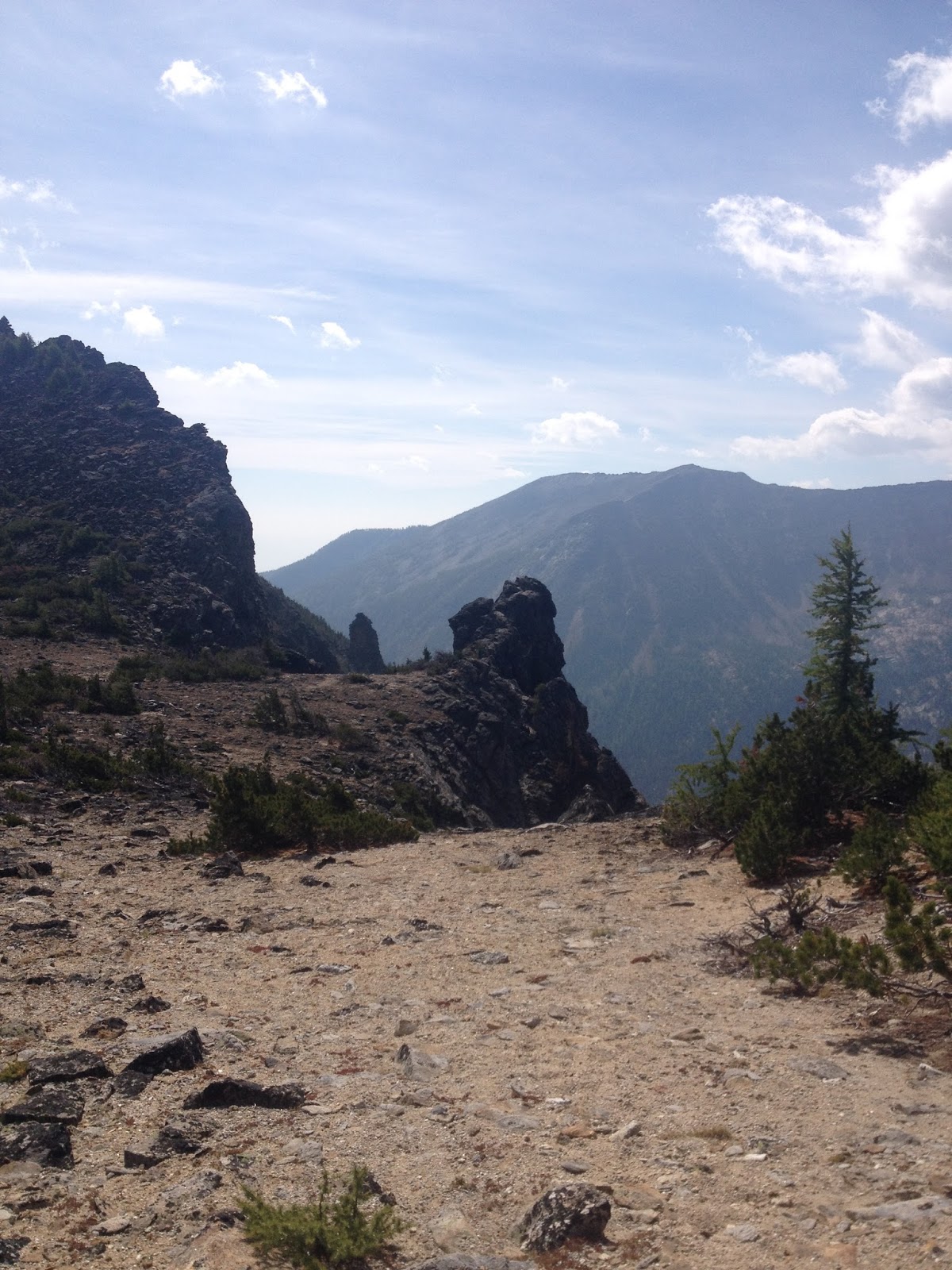
| The view from Carlton Ridge. About 4 miles into the Lolo Peak hike. Notice that there is a lot less smoke today. |
 |
| A photo of the false summit. There is another mile to go after you make it up this ridge. |
 |
| On the damn at Carlton Lake. |
 |
| We gained the ridge. Getting to the ridge is the steepest part of the trip |
 |
| Lakes all over this area. I have been told that they are all decent fishing. I will bring a rod with me next time. |
Thanks to all the chasers who took the time to come and find me, and Mike (KE5AKL) who took the time to work with me on the S2S contact. A special thanks to Dean (KJ6CQC) for giving me a call and letting everyone locally know that I was up on the summit. Dean also sent me an APRS message, it was good to see this feature work on the radio!
My time is much more limited then it was a couple years ago. It seems that my kids are getting older and more demanding of my time. The Army is expecting more time from me also. Just this last summer I went over my 18 year mark in the Army. I know this sounds like OMP (Old man problems) but the military has taken its toll on me. I can still get out and travel some miles but the consequences are getting worse as I get older :) Thanks again!
Summit information and resources used for planning
I use this app to estimate distances of new trails.
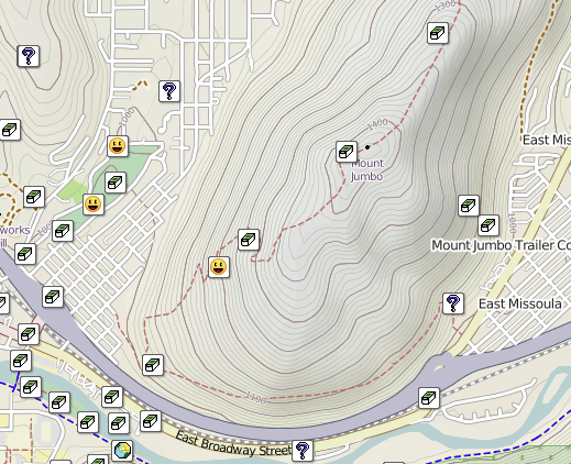
Here is one of my secrets!!! Even if you don't do geocaching take a look at the map. If you manipulate it right up can see every summit out there. If there is a geocache at the top, there is a way to get there. Sometimes if you click on the cache it will even give detailed directions to get there and some good pictures.
Here is an example of some decent directions learned from a geocache. The information was out dated but much of the time it is not.
I link to this site from my blog and from my blog to this site. This site is great because it posts the necessary information straight to the Summit Page.
Adventure Radio Map View - I like this map as a way to see the summits. It seems more user friendly with filters then the SOTA mapping software.
http://www.nohrsc.noaa.gov/interactive/html/map.html
NOHRSC Interactive Snow Information - This is a great tool to see where the snow levels are and what they have looked like in the past on certain dates.
http://www.gpsvisualizer.com/draw/
Put in a route in this site and it will give you a gps file for the information you provide. This works if you want to draw and upload a route into your GPS for use on the trail.
No comments:
Post a Comment